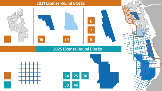
PGS has acquired 3D seismic data covering most of the available opportunities in the Angola 2021 bid round for offshore Kwanza and the Lower Congo Basin.
This was done in partnership with Agência Nacional de Petróleo, Gás e Biocombustíveis for a round under Angola’s Petroleum Activities Law, which seeks to award eight areas.
The PGS data library coverage uses a combination of 3D GeoStreamer technology and modern imaging techniques to unlock plays and opportunities in the blocks on offer.
- Blocks 7/21 and 8/21 on Kwanza Shelf revealed in 3D GeoStreamer quality
- Block 16/21 in the Lower Congo Basin revealed in 3D GeoStreamer coverage
- Block 34/21 Lower Congo Basin covered by conventional 3D data
The megaSurvey encompasses regional coverage of 45 000km² with information on thickness trends, structural setting, depositional environments, and play fairways (includes blocks 31/21, 32/21, 33/21)
“The proven prospectivity of the Angola offshore area has been evidenced by numerous oil and gas discoveries. PGS data and geoscience studies provide excellent coverage of the opportunities, enabling regional understanding of the hydrocarbon potential offshore Angola and supporting block-level analysis of the areas on offer.
”This will permit companies to gain geological understanding, derisk petroleum systems and plays, and unlock opportunities,” says Christine Roche, Sales Manager West Africa at PGS.
Canada capture
In other news PGS, on behalf of the PGS-TGS joint venture, has acquired over 10 000km2 of 3D GeoStreamer data offshore Newfoundland and Labrador between May and September this year. Fast-track results will be delivered in December 2021 and final imaging products will be ready Q1 2022.

The data from this year’s program expands the footprint of the PGS-TGS joint venture offshore Newfoundland and Labrador to approximately 80 000 sq. km. The focus of the 2021 acquisition was on the Cape Anguille survey in the Orphan Basin, with strategic additional acquisition on Lewis Hills and Jeanne d’Arc,
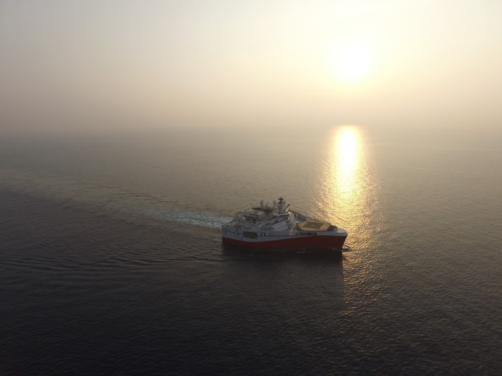
Marine seismic acquisition on these project areas was carried out by the Ramform Atlas and Ramform Titan, in compliance with strict Covid-19 guidelines.
“We are very pleased the PGS-TGS joint venture has completed the 11th consecutive acquisition season offshore Canada. Two Ramform Titan-class vessels were active for the full season, with tailored GeoStreamer towing configurations. The new datasets expand our 3D MultiClient coverage for this region to 80 000 square kilometers and will help our clients to further de-risk prospects and plays offshore Canada,” says Rune Olav Pedersen, President & CEO of PGS.
“We’re pleased to have completed another successful acquisition season offshore East Coast Canada – further strengthening our energy data library and position in the region. The data acquired will contribute to our client’s efforts to de-risk their investments in future bid rounds,” says Kristian Johansen, CEO at TGS.
Areas included:
Cape Anguille
This industry prefunded 3D GeoStreamer survey responds to existing industry interest and builds on seismic surveys to create a continuous 3D coverage in the Orphan Basin. Data acquired in 2021 has been added to our continuous coverage of areas relevant for the call for bids in 2022 and 2024.
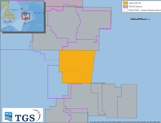
Lewis Hills Phase 2
Additional 3D coverage links the Flemish Pass and Orphan Basin, creating a continuous dataset to support ongoing exploration drilling programs. This data will be key in enhancing understanding petroleum systems at play, and builds on Lewis Hills Phase 1 (acquired 2018) over Exploration License (EL) 1138
Jeanne d’Arc Phase 2
PGS said it was closer to the goal of offering modern HD3D data over the entire producing area of the Jeanne d’Arc basin and described the result as: “Perfect for new players evaluating the basin and will provide new insights to operators with significant exploration commitments in the area. JDA Phase 1 was acquired in 2019. Phase 2 data will create a more unified dataset over the basin, to further enhance understanding of the exploration potential.”


