
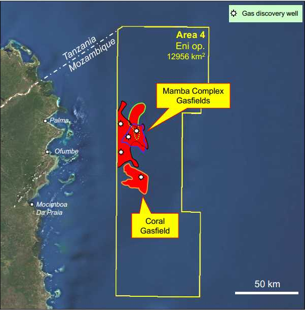
SUPERMAOR ExxonMobil has signed a sale and purchase agreement with Eni to acquire a 25% indirect interest in the natural gas rich Area 4 block, offshore Mozambique. In a joint statement the two companies said terms included a cash price of approximately US$2.8 billion and that the acquisition would be completed on a number of condition precedents being met, notably clearance from Mozambican and other regulatory authorities. Eni holds a 50% indirect share in the block via a 71.
Latest News
Po Valley exclaims ‘Mamma Mia’ at licence award
Australian listed oil and gas exploration, development and production company, Po Valley Energy Ltd (ASX: PVE), which has energy assets in northern Italy, has been granted the large onshore Torre del Moro oil exploration licence, located southeast of Bologna, in the eastern Po Valley region of Italy. Po Valley said the licence covers an area of 111km2 and contains a large, attractive oil exploration target. The licence has a six year initial exploration period. Its main exploration play is a Mesozoic carbonate structure with structural analogies to the ENI Villa Fortuna field (230 million bbls produced).
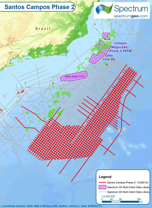
Spectrum concludes Santos Campos survey offshore Brazil
Spectrum has completed of the 17,700 km2 Santos Campos Ph.2 2D seismic survey offshore Brazil. Spectrum said the new acquisition program was an outboard extension of Spectrum’s 2012 Santos Campos Phase 1 survey, and ties other programs in the Santos, Campos and Espirito Santo Basins producing a continuous dataset covering the prolific pre-salt oil fields in these basins. The survey has been acquired with a 12,000m cable to record data necessary to understand basin architecture as well as to image prospective zones in the pre-salt section.
APPEA calls for gas rollout to slash Aussie emissions
Australia should seek to emulate the United States in slashing its emissions through increased use of natural gas for generating electricity. This was said by APPEA Chief Executive Dr Malcolm Roberts in his assertions that Australia was squandering an historic opportunity to significantly reduce emissions from the generation sector by switching to natural gas. “Energy-related emissions in the US in the first half of 2016 were at their lowest level since 1991, having fallen about 13 per cent since their peak in 2007,” said Dr Roberts. “The biggest reason for this dramatic fall is the increased use of natural gas.
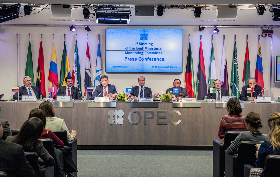
OPEC says oil production cuts can slice deeper
The Joint OPEC-Non-OPEC Ministerial Monitoring Committee (JMMC) has reported that OPEC and non-OPEC countries are on the right track towards full conformity with their adjustments in production, but there is still room for improvement. This emerged after the Joint OPEC-Non-OPEC Technical Committee (JTC) held its inaugural meeting on February 22 at the OPEC Secretariat in Vienna, where conformity with production level cuts featured high on the agenda. The cuts decided on by OPEC in November last year were the first since 2008.

PESA benefit that saves home buyers a small fortune
Many people working in the oil and gas sector are unaware of a “hidden’’ benefit of PESA membership that can save them thousands of dollars, reports Christina Granger. Some major lenders offer a waiver of lenders mortgage insurance (LMI) to PESA members, which can equate to a benefit of many thousands of dollars. LMI must be paid by most people who borrow more than 80% of the value of a property, whether that is a owner-occupied home or an investment property.

PGS cuts losses in fourth quarter.
MARINE geophysical company PGS was hit by a 33 per cent decline in revenue in the fourth quarter, but revealed in its quarterly report that its net loss had dropped to US$156.1 million compared to US$334 million in the corresponding period of 2015. The company’s net loss before tax was US$118.7 million, compared to US$357.1 million in the prior-year quarter. The company recorded impairment charges, excluding impairment of MultiClient library, of US$12 million for the full year 2016 and US$7.8 million in the fourth quarter. This primarily related to adjustments to the expected schedule for returning cold-stacked vessels to operation.
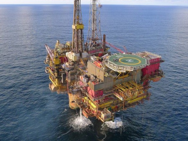
Shell submits program for Brent field decommissioning
Shell has submitted its decommissioning program for the Brent oil and gas field in the UK sector of the North Sea to the Department for Business, Energy and Industrial Strategy (BEIS). Shell said that after submission of the plan, an extended 60-day public consultation on recommendations to decommission the Brent field would commence. Located 115 miles north-east of the Shetland Islands, the Shell-operated field has produced about three billion barrels of oil equivalent since production started in 1976. This represents almost 10% of UK production.
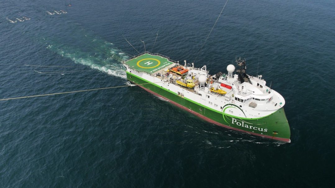
Polarcus lands 4D project off West Africa
Marine seismic acquisition firm Polarcus has been awarded a 4D marine seismic acquisition project offshore West Africa. Polarcus announced the contract award but did not disclose financial details or reveal who the client was. The marine seismic player said that the project is scheduled to start in the second quarter of 2017 and it would run for approximately one month.The project represents Polarcus' second in West Africa since the start of 2017. In early January it announced a letter of intent for an offshore broadband 3D marine seismic acquisition project in the region.

TGS back to black in fourth quarter
Multi-client geoscience data provider TGS returned to profit during the fourth quarter of 2016, reversing a substantial loss compared to the corresponding quarter of 2015. TGS reported a profit of US $23.9 million for 4Q 2016, as opposed to a US$121.5 million loss in the prior-year quarter. The company’s revenues increased to US$164.7 for the quarter, significantly up from US$131.7 million in Q4 2015. TGS said its backlog had decreased by 65% to US$51.2 million, compared to 4Q 2015, mainly as a result of high production on the Gigante projects offshore Mexico which was completed during the quarter.