
Subsurface Imaging, part of CGG’s Geoscience division, has delivered a step-change in subsalt image quality over the Mad Dog field in the Green Canyon area of the Gulf of Mexico. CGG said that through continued investment in imaging technology and supercomputing capacity, the company was able to reduce project cycle time by almost half while delivering greatly improved subsalt images. Fast access to high-quality images was critical to BP and partners in modifying and optimizing the ongoing drilling program.
Seismic (public)

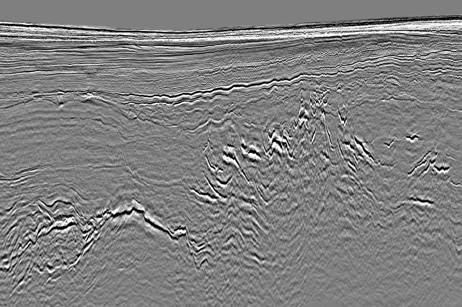
NW of Shetlands insight with new generation of blended seismic
Step-change in source deblending enables bespoke, high-density acquisition designs to address difficult geological scenarios, CGG revealed in a recent release, highlighting advancements in seismic developments and a new world opening up in related spin-offs. Among many recent seismic technology advances, there has been a step-change in source deblending. This has enabled the design of surveys, which use multiple sets of simultaneous sources to provide bespoke imaging solutions for a range of challenging environments. Typically, this includes a dramatic increase in source density and the collection of additional offset-azimuth coverage without losing fold and near offset coverage.
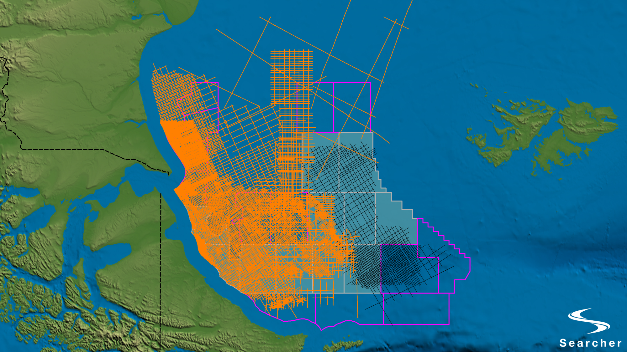
Searcher announced expansion of Argentina Data Library
Searcher has announced the expansion of the Argentina Super-Tie 2D Reprocessing Project. Following the success of phase 1 which specifically targeted the recent offshore bid round, the project has now been extended to include all available offshore 2D seismic data in the Malvinas and Austral Basins, Searcher said. The reprocessing effort will utilize a modern broadband and AVO compliant workflow to both improve imaging quality and provide regionally consistent data coverage.
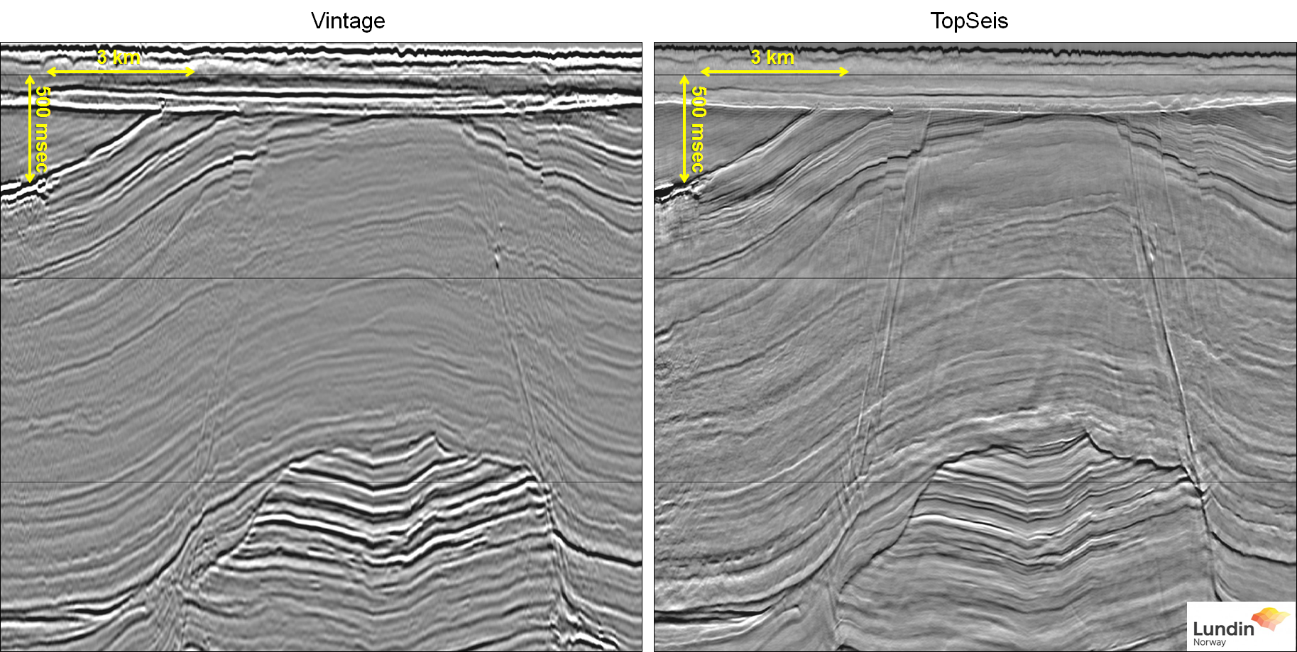
CGG and Lundin Norway win NCS Exploration Innovation Prize 2019 for TopSeis
CGG and Lundin Norway AS have been awarded the NCS Exploration Innovation Prize 2019 for TopSeis™, a next-generation marine source-over-spread acquisition and imaging solution that delivers a step-change in imaging by providing massively increased near-offset coverage from a split spread with zero offsets. The Exploration Innovation Prize is “awarded to a license group, company, team or person who, during the last couple of years, has given a courageous and innovative technological contribution in exploration for oil and gas on the Norwegian continental shelf.
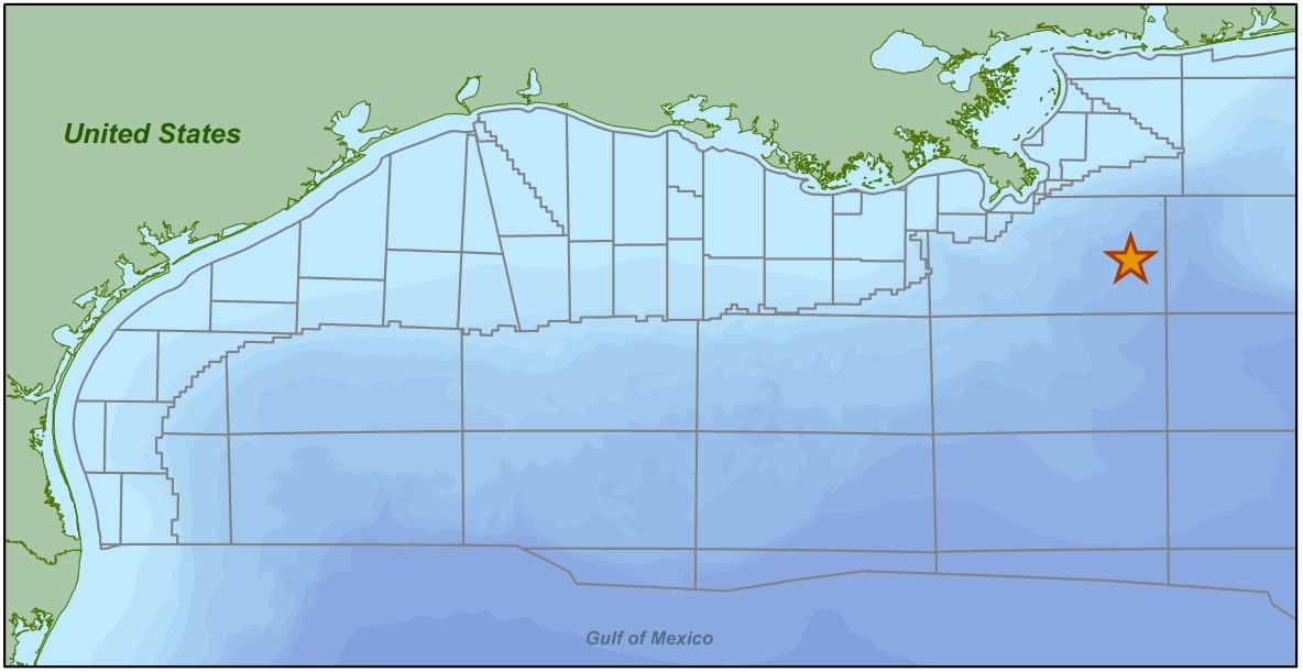
CGG Begins First Multi-Client Ocean Bottom Node Survey in Mississippi Canyon, Gulf of Mexico
CGG has announced commencement of its first multi-client ocean bottom node (OBN) survey, taking CGG’s offshore data library to the “next level of excellence”. Located in the north-central region of the Gulf of Mexico, this dense OBN survey will provide well-sampled, full azimuthal coverage with long offsets, to deliver exceptional data for imaging the geologically complex structures in Mississippi Canyon, CGG said. Acquisition services are being provided by Seabed Geosolutions and the data will be processed by CGG Geoscience’s Subsurface Imaging in Houston.
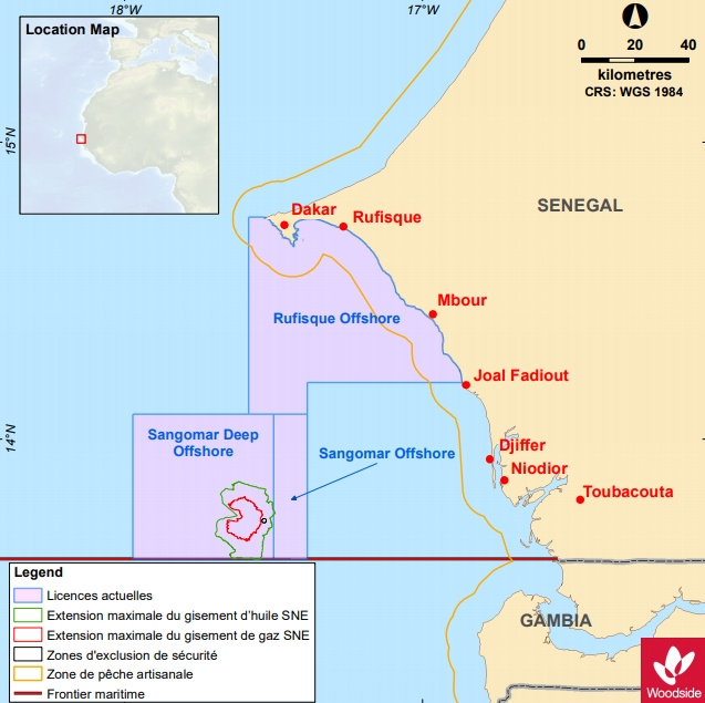
Shearwater set to shoot seismic at SNE field
Shearwater has won a contract to conduct a 3D seismic survey over the SNE field offshore Senegal. This was revealed in a first quarter update recently by FAR, which said the high-definition 3D marine seismic survey contract was awarded to improve reservoir definition supporting SNE well positioning and optimization. FAR said the survey was scheduled to begin in June as part of the SNE field development encompassing the Rufisque Offshore, Sangomar Offshore and Sangomar Deep Offshore (RSSD) joint venture, which is operated by Woodside and includes JV-partners Cairn Energy, FAR Limited, and Petrosen.
It’s Mama Mia for Po Valley in Italy
Australia’s Po Valley Energy has announced maiden oil and gas condensate Prospective Resource estimates for its large onshore oil exploration holdings in northern Italy. The gains cover the Torre del Moro Exploration Licences southeast of Bologna, the Bagnolo SW prospect in Cadelbosco licence, and a large 334% increase in the 2C resources in its Bagnolo in Piano and Ravizza oil fields in the Cadelbosco Grattasasso Exploration Licences. These two oil fields and the oil / condensate prospects are 100%-owned by Po Valley.
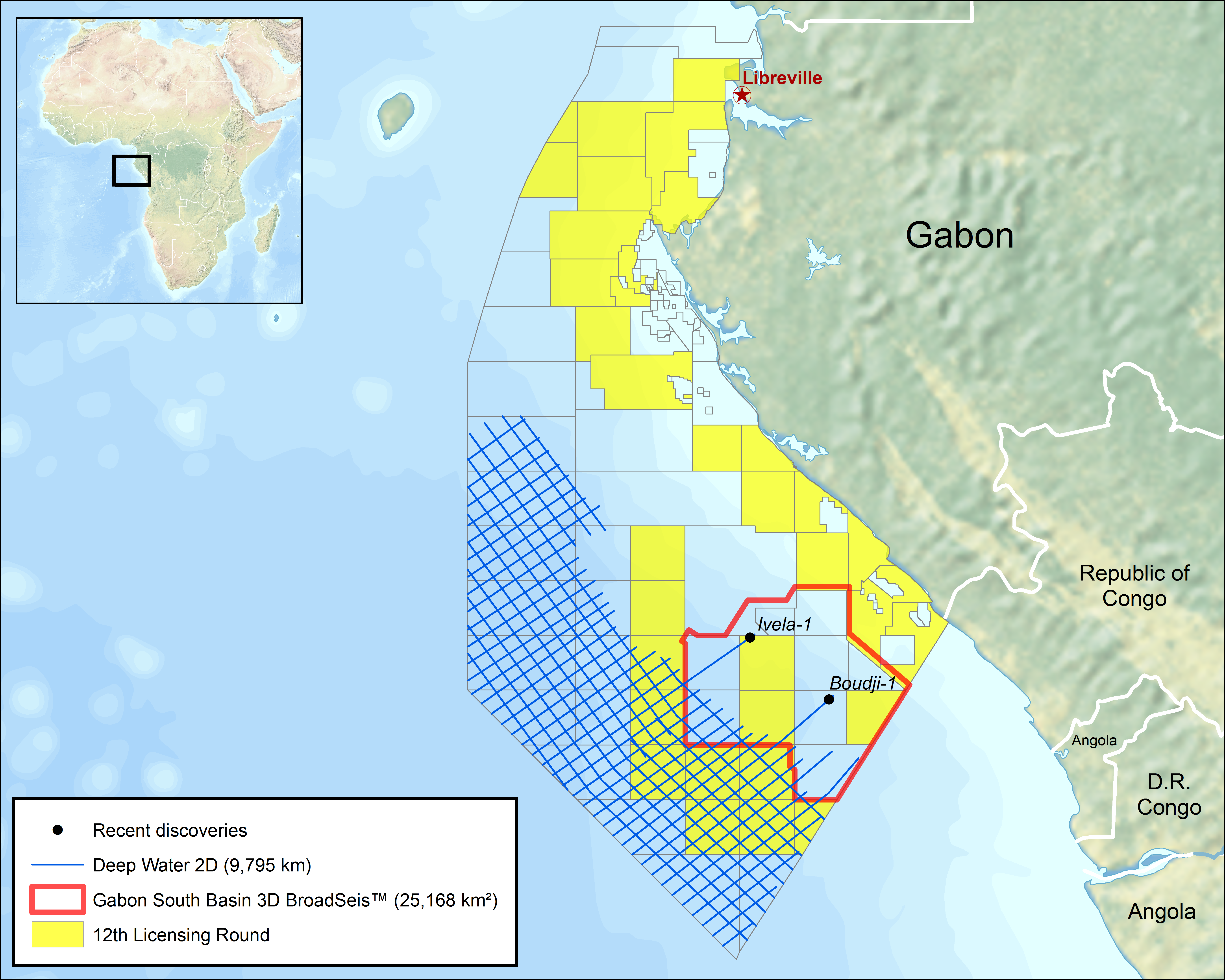
CGG completes 2D survey offshore Gabon
Acquisition of CGG’s 9,800 km long-offset broadband 2D multi-client seismic survey in the highly prospective Gabon South Basin has been completed. Fast-track data sets will be delivered in batches from the end of April, giving interested oil companies sufficient time to understand offshore petroleum systems and appraise blocks offered in Gabon’s 12th offshore licensing round planned for September 2019. This modern data set will help define the full extent of existing and new plays in the region. It will also aid in understanding the thickness variations in the sediment overburden for source rock and maturity analysis.
Shell applies for 3750 km2, 3D seismic survey off Western Australia
Shell has applied to offshore safety regulator NOPSEMA to conduct a 3750km2seismic survey offshore Kimberley, Australia. The oil and gas major plans to launch the “Factory” 3D marine seismic survey within the Browse and Bonaparte Basin, off Western Australia. The Factory 3D survey will comprise acquisition of approximately 3,750 km2 of 3D seismic data in Exploration Permits AC/P65, AC/P41, WA-534-P, and a smaller section of adjacent acreage to acquire data to fully-image the prospects on the titles, NOPSEMA said.
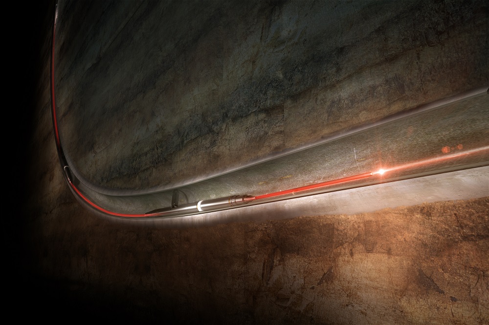
Sercel Extends Boundaries of Well Exploration with SigmaWave, its First DAS Seismic Solution
Sercel has announced the launch of its first distributed acoustic sensing (DAS) seismic solution: SigmaWave. Designed in partnership with Fotech Solutions, SigmaWave is the first integrated distributed acoustic solution designed exclusively for borehole seismic applications and reinforces Sercel’s advanced range of downhole seismic acquisition systems. SigmaWave is fully integrated with Sercel’s existing downhole seismic tools and enables continuous, real-time seismic measurements along the entire length of a fiber optic cable. Whether by retrievable or permanent deployment, it is now possible to visualize and monitor the well in real time and instantly generate SEG-Y files.