
Please note that we are still in the process of re-tagging our library items. This means searches using Author, Year, Publication Type and Title may not show complete matches.
LIST
TILES

Interpretation of basin structure from high resolution aeromagnetic data: an example from the Officer Basin of South Australia
- Publication Name: PESA's Eastern Australasian Basin Symposium II
- Authors: C.A. Foss, Z.S. Shi, J. Teasdale, L.L. Pryer, T.S. Loutit, P.G. Stuart-Smith and K. Romine
- Reference Type: Book Section
- Date Published: December 2004
Abstract:
The aeromagnetic coverage over the Officer Basin has been used to map basement terranes and depth to basement beneath the basin. The fundamental ambiguities of non-uniqueness in magnetic field interpretation have been minimized by using geological so...

Tectonic and volcanic history of the Carnarvon Terrace: Constraints from seismic interpretation and geodynamic modelling
- Publication Name: The Sedimentary Basins of WA
- Authors: R.D. M?ller, D. Mihut, C. Heine, C. O'Neill & I. Russell
- Reference Type: Book Section
- Date Published: December 2002
Abstract:
The under-explored Carnarvon Terrace, part of the offshore Carnarvon Basin, represents one of the remaining frontier areas on the northwest Australian margin. To assess the tectonic and volcanic evolution of this area, we have interpreted 6,700 km of...
Borehole image log interpretation: making the most of your data and understanding its limits; an illustration using shallow and deep marine, fluvial, and carbonate depositional environments
- Publication Name: The Sedimentary Basins of WA
- Authors: A.A. Bal, K.A.A. van Noord, P.V. Grech & J.D. Prosser
- Reference Type: Book Section
- Date Published: December 2002
Interpretation of Burial and Diagenetic History of Northland Allochthon Rocks, Northland Basin, New Zealand
- Publication Name: Eastern Australian Basins Symposium 2001
- Authors: N. Aadil, P. Black and P.F. Ballance
- Reference Type: Magazine Article
- Date Published: November 2001
Abstract:
Northland Allochthon is a structurally displaced rock unit comprising an originally fining-upwards passive margin wedge which accumulated adjacent to northeastern New Zealand between the Middle Cretaceous
and Late Oligocene. The wedge was obducted on...
A Structural Interpretation of the Gascoyne Platform, Southern Carnarvon Basin, WA
- Publication Name: The Sedimentary Basins of WA
- Authors: Robert P. Iasky, Arthur J. Mory and Sergey I. Shevchenko
- Reference Type: Book Section
- Date Published: December 1998
Abstract:
The Gascoyne Platform is a sub-basin with relatively shallow basement in the Southern Carnarvon Basin, extending for 600 km between the Northampton Complex to the south and the Exmouth Sub-basin to the north. The platform contains mainly ?Ordovician-...
Technical Focus: New Magnetic Interpretation Tools Assist Petroleum Exploration – Christian Ellis, Paul Cartwright, Andy Cabell, Julien Flack and Stewart Rodrigues
- Publication Name: PESA News
- Authors: Christian Ellis, Paul Cartwright, Andy Cabell, Julien Flack and Stewart Rodrigues
- Reference Type: Magazine Article
- Date Published: April 1997
Abstracts of Talks: Tectonic Models and Seismic Interpretation – John K. Davidson, Integrated Structural and Stratigraphic Analysis in PPL 175, Papuan Fold Belt, Papua New Guinea – Roger Thornton
- Publication Name: PESA News
- Reference Type: Magazine Article
- Date Published: February 1997
Prospectivity: Carnavon Questions Leatherback Interpretation
- Publication Name: PESA News
- Reference Type: Magazine Article
- Date Published: August 1996
Product Focus: Interpretation & Modelling Services from IKODA – Dr Alan Stein, Geo-Digital
- Publication Name: PESA News
- Reference Type: Magazine Article
- Date Published: October 1995
Technical Focus: Focus of 3D Interpretation Software/Value in the Third Dimension – Richard Wilson
- Publication Name: PESA News
- Reference Type: Magazine Article
- Date Published: August 1995
Skill Share: A Primer for Interpretation Reports
- Publication Name: PESA News
- Authors: Ken Grieves
- Reference Type: Magazine Article
- Date Published: June 1994
Abstract:
In this issue (PESA News 10) we introduce a new section where members can pass on suggestions, ideas, criticisms, etc. of various skills, techniques, procedures they have or would like to learn about. If you have a pet hate or a suggestion for how th...
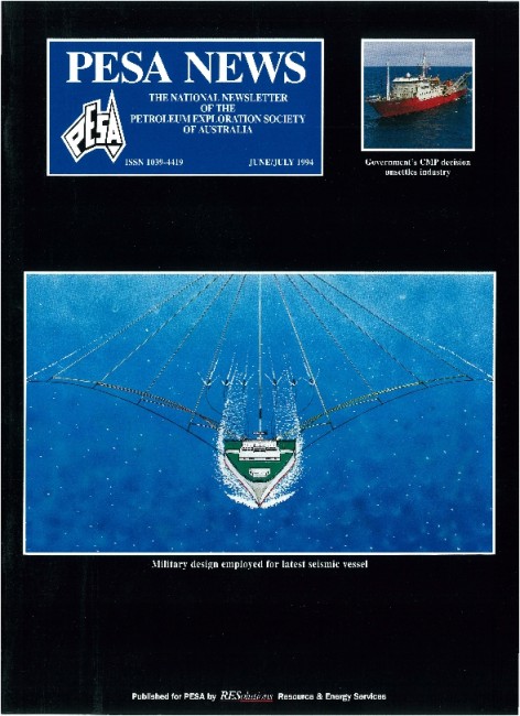
Seismic Interpretation Problems Caused by Miocene Channels in the Central Part of the Gippsland Basin
- Publication Name: Gippsland Basin Symposium, Melbourne, 22 ? 23 June 1992
- Authors: T U MAUNG, S J CADMAN
- Reference Type: Conference Proceedings
- Date Published: December 1992
Abstract:
The central part of the Gippsland Basin is surrounded by existing major
petroleum accumulations and although six exploration wells have been
drilled in the area, none are significant petroleum discoveries. Post
drilling analyses indicate that the wel...

Seismic-stratigraphic interpretation of coastal barrier systems of Late Eocene age, offshore Gippsland Basin
- Publication Name: Second South-Eastern Australia Oil Exploration Symposium - Technical Papers
- Authors: R. Blake
- Reference Type: Book Section
- Date Published: December 1986
Abstract:
Three seismic-stratigraphic sequences were mapped within the uppermost Latrobe Group at the western
end of the offshore Gippsland Basin. The three sequences are interpreted to be Upper Eocene coastal barrier complexes deposited under conditions of lo...

Tectonic development of Victoria’s Otway Basin – a seismic interpretation
- Publication Name: Second South-Eastern Australia Oil Exploration Symposium - Technical Papers
- Authors: M. Megallaa
- Reference Type: Book Section
- Date Published: December 1986
Abstract:
This paper is essentially an extract from the author's contribution in a recent appraisal of regional seismic
mapping in the Victorian sector of the Otway Basin by the Department of Industry, Technology and Resources
(Megallaa, in press). Geological ...
A 3D seismic interpretation – Flounder Field, Gippsland Basin
- Publication Name: Second South-Eastern Australia Oil Exploration Symposium - Technical Papers
- Authors: A.J. Young and R.R. Coenraads
- Reference Type: Book Section
- Date Published: December 1986
Abstract:
Flounder-1, drilled in 1968, proved the presence of intra-Latrobe hydrocarbon-bearing sands of Late Cretaceous age. Five step-out wells were drilled before the field could confidently be classified as commercial. Prior to development, it was decided ...
Comparison and Geologic Interpretation of Alternative Dipmeter Analyses from a Permo-Carboniferous Sequence in the Fitzroy Graben
- Publication Name: The Canning Basin, W.A.
- Authors: Barry A. Goldstein and John J. Hubbard
- Reference Type: Book Section
- Date Published: December 1984
Abstract:
The acquisition of both HDT and SHDT measurements through 710m of Permo-Carboniferous siliciclastics in the Fitzroy Graben provides the opportunity to compare results of alternative dipmeter analyses.
Based on comparisons to cores and seismic interpr...

Systematic Landsat Interpretation in Arid Environments – A Cost Effective Aid to Petroleum Exploration
- Publication Name: The Canning Basin, W.A.
- Authors: A. C. Theron, C. R. Nash, N. H. Lockett and M. C. Baker
- Reference Type: Book Section
- Date Published: December 1984
Abstract:
Efficient utilisation of Landsat imagery in petroleum exploration depends upon methodical gathering of structural and geomorphic data, integration of these data with existing geophysical and geological information,
and ultimately the construction of ...

The Application of Landsat Imagery in Structural Interpretation of the Canning Basin, W.A.
- Publication Name: The Canning Basin, W.A.
- Authors: J. Craig, J.W. Downey, A.D. Gibbs and J.R. Russell
- Reference Type: Book Section
- Date Published: December 1984
Abstract:
Detailed analysis of Landsat imagery, integrated with published geological and geophysical data has provided
a basis for a re-examination of the structural geology of the Canning Basin and adjacent areas. The Landsat interpretation provides a substan...

Interpretation of Additional Conodont Colour Alteration Data and the Thermal Maturation and Geothermal History of the Canning Basin, Western Australia
- Publication Name: The Canning Basin, W.A.
- Authors: Robert S, Nicoll and John D. Gorter
- Reference Type: Book Section
- Date Published: December 1984
Abstract:
Examination of conodont colour alteration (CAl) in samples from 59 petroleum exploration wells and extensive
outcrop collections along the northern margin of the Lennard Shelf forms the basis for a study of the thermal maturation and geothermal histo...