By John Coffin
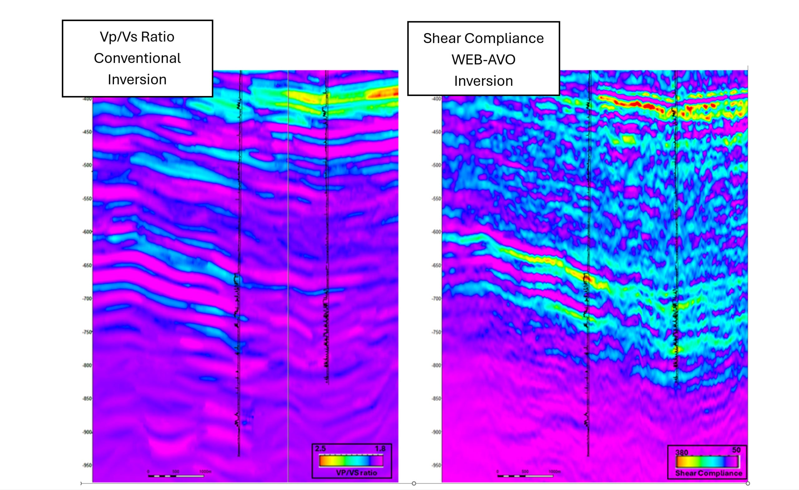
This year we have seen plenty of publicity and interest in elastic full waveform inversion, or eFWI and the potential benefits and advantages it can provide. At Delft Inversion we have been using eFWI for over 12 years focussing on quantitative interpretation and seismic reservoir characterisation. This article explains how and why we do this.
The eFWI technology developed at Delft Inversion is called WEB-AVO which stands for Wave Equation Based AVO inversion. So, what does this mean? We solve the integral representation of the wave equation.

