- This event has passed.
PESA ACT/NSW July Technical Meeting 2022
Tuesday, 12 July, 2022 @ 12:00 pm - 2:00 pm (Australia/Sydney time)
$15.00 – $75.00Notice: Meeting Cancelled
Structure of the Southern Sydney Basin: Where Sydney gets its Water & The World Gets Coal
The Southern Sydney Basin or Illawarra Coalfields was an economic and industrial powerhouse during the development of the Colony of New South Wales. With the increased population of Australia, it has become the critical catchment for Sydney’s water with a significant number of large dams and associated catchment exclusion zones. The region is also dissected by incredibly valuable rail, road, telecommunications, and gas infrastructure. With all this development, coal mines and mineral quarries have continued to be developed in the region.
Counterpointing this industrial development has been the gentrification and urbanisation of the area. Many of the large rural properties have been divided into small holdings and are now subdivided into housing developments. Urbanisation leads to an increasing number of stakeholders when reviewing mining developments.
With continued subdivision, industrial farming, and mining, it is essential to consider the impact on water supplies. Over the past decades, a range of controversies has evolved over the possible impacts of longwall mining on the dewatering of Thirlmere lakes, subsidence impacting the Hume Highway at Appin and rivulets at Dendrobium. It continued with the political “Battle for Berrima’s” opposition to the Hume Coal project.
It is vital to develop a robust sequence stratigraphic and 3D structural model for the region to model environmental risks associated with development. Build a consistent 3D model of the aquifers and aquitards to allow constant groundwater models to be run. Whilst not immediately evident, a series of significant structural features control the basin architecture and present geometry.


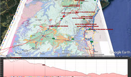
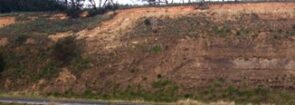
As you drive down to Sydney at the highest point (~770m), you can stop and see a low-angle fault in the Ashfield Shale, then over the next 60km, drop 700m to Campbelltown (~60m).
It is proposed that a series of relatively large displacement faults have inverted the basin. The key topographic forming Hawkesbury Sandstone is very competent, tending to form folds rather than through-going faults. The development of a 4D model for the basin has significantly impact water supplies, groundwater and seismic risk assessment in this critical corridor.


